 2024, Vol. 45


2. 山西省林业和草原科学研究院, 太原 030012
2. Shanxi Academy of Forestry and Grassland Science, Taiyuan 030012, China
工业革命以来, 化石燃料的燃烧和土地利用的变化, 使大气中温室气体特别是二氧化碳(CO2)浓度激增[1], 从而导致全球平均温度持续上升. 陆地生态系统是地球上重要的碳汇, 每年抵消超过30%的人为碳排放量[2]. 净生态系统生产力(NEP)是陆地生态系统与大气之间的净碳交换, 是定量评价陆地生态系统碳源/汇的重要指标[3]. 在气候变化和人为干扰的背景下, 准确掌握陆地碳源/汇的时空变化并揭示其驱动机制对区域可持续发展和全球碳减排具有重要意义.
中国以其约占全球6.5%的陆地面积, 贡献了相当于全球陆地生态系统净CO2吸收量的10%~31%, 表明中国陆地生态系统在全球生态系统碳汇中具有重要作用[4]. 自2000年以来, 中国植被NEP整体呈增加趋势[5], 然而不同区域NEP的年际变化趋势并不相同. 2000~2020年西南地区[6]和2000~2015年青海高原[7]的NEP呈显著地上升趋势, 而2000~2020年海南岛森林NEP呈现不显著地下降趋势[8]. 区域NEP的时空变化是多因素共同作用的结果[9~11]. 气候变化可以驱动植被动态变化和调节土壤呼吸, 从而影响陆地生态系统的碳循环[6~8]. 一般而言, 降雨充沛和太阳辐射充足, 加之较高的气温, 有利于促进植物的光合作用, 进而增强植被的碳汇能力[5]. 人类活动(植树造林、生态修复和森林经营等)是驱动区域尺度生态系统碳源/汇时空变化的重要因素[12, 13]. 据报道, 退耕还林工程实施后黄土高原净初级生产力(net primary productivity, NPP)、NEP及碳储量均呈增长趋势[14];生态保护工程实施后三江源地区NEP呈显著上升趋势[15], 碳汇功能显著增强. 不同区域气候变化和人类活动对NEP的贡献率有很大差异[6]. 综上所述, 我国不同区域植被NEP变化趋势及对不同驱动因子的响应, 均存在显著的时空差异, 因此, 有必要针对区域尺度, 结合时空动态演变分析来揭示区域NEP变化的驱动机制.
黄土高原地域广阔, 气候类型多样, 自然地理条件复杂和空间组合变化明显, 降水和气温空间分布很不平衡, 植被覆盖存在很大的空间异质性[16], 是世界上水土流失最严重和生态环境最脆弱的地区之一[14, 17]. 近20年来, 随着退耕还林/草、天然林保护和山水林田湖草等工程的实施, 该区的植被覆盖度得到极大改善, 植被的固碳能力显著提高[18]. 对生态系统碳源/汇的研究多集中于黄土高原整个区域陆地生态系统的NPP、碳储量的研究[19~21], 而对不同生态分区陆地生态系统碳源/汇的时空变化规律及环境因子驱动机制仍然相对缺乏. 为此, 本文依据杨艳芬等[16]的黄土高原生态分区结果, 结合遥感、气象、地形和人类活动数据, 探析2000~2021年黄土高原及其6个生态分区NEP的时空分布特征、变化趋势及其对不同驱动因子的响应, 量化自然和人类活动因子对NEP变化的贡献, 以期为黄土高原减排增汇、实现双碳目标提供理论参考.
1 材料与方法 1.1 研究区概况黄土高原(33°41′~41°16′N, 100°52′~114°33′E)位于中国中部偏北, 总面积达6.4 × 10⁵ km2. 属大陆性季风气候, 全年≥10℃的积温2 300~4 500 ℃, 无霜期120~250 d, 日照时数1 900~3 200 h[22], 年平均气温3.6~14.3 ℃, 年降水量150~800 mm[23], 降水自东南向西北、由山地向平地递减, 年际变异较大, 年内分布也不均匀[16]. 地势西南高、东南低, 海拔85~3 700 m. 地貌类型多样, 由丘陵、高塬、平原、沙漠、草原和土石山地等组成, 其中山区、丘陵区和高塬区占2/3以上. 土壤类型主要有黄绵土、褐土、黑垆土等. 植被具有明显的分区差异, 从东南向西北依次为森林草原、典型草原和半荒漠草原. 杨艳芬等[16]依据国家发改委的分区原则和方法, 综合考虑了黄土高原水土流失治理技术、模式和生态恢复建设工程的区域性差异, 将黄土高原划分为4个生态分区:黄土高塬沟壑区(A)、黄土丘陵沟壑区(B)、沙地和农灌区(C)和土石山区及河谷平原区(D). 其中黄土高塬沟壑区以六盘山为界, 划分为A1和A2两个副区;黄土丘陵沟壑区以毛乌素沙漠南缘为界, 划分为B1和B2两个副区(图 1).

|
A:黄土高塬沟壑区, A1:黄土高塬沟壑区A1副区, A2:黄土高塬沟壑区A2副区;B:黄土丘陵沟壑区, B1:黄土丘陵沟壑区B1副区, B2:黄土丘陵沟壑区B2副区;C:沙地和农灌区;D:土石山区及河谷平原区 图 1 研究区位置及高程示意 Fig. 1 Location and elevation of the study area |
本研究使用了由美国国家航空航天局数据中心(http://ladsweb.modaps.nasa.gov/)提供的MODIS Terra NPP数据(MOD17A3HGF)用于NEP的估算, 空间分辨率为500 m, 时间分辨率为1 a, 时间跨度是2000~2021年.
数字高程模型数据来源于由美国国家航空航天局(NASA)和美国国家测绘局(NIMA)联合测量的SRTM产品, 空间分辨率90 m. 坡度(slope)和坡向(aspect)数据基于高程(ele)数据计算得到.
气温和降水量数据来源于国家地球系统科学数据中心——黄土高原分中心(http://loess.geodata.cn), 时间分辨率为月度, 空间分辨率为1 km[24], 月气温数据求平均值获得年平均气温(T), 月降水量数据求和得到年降水量(P), 时间跨度均为2000~2021年;年太阳总辐射(SR)数据来自中国气象数据网(http://data.cma.cn/), 通过对逐日日照时数数据进行计算得到年太阳总辐射数据, 并利用ArcGIS 10.2软件采用反距离权重插值法(IDW)将站点数据插值成栅格数据[25], 时间跨度为2000~2021年.
人类活动强度(HA)数据来自Mu等[26]的研究, 该数据从多个来源收集8类人类压力变量(即建筑环境、人口密度、夜间灯光、农田、牧场、公路、铁路和通航航道), 生成年度全球人类足迹数据集来综合表示人类活动强度, 空间分辨率为1 km, 时间跨度为2000~2018年.
将所有数据统一投影至WGS1984/UTM 49N坐标系, 空间分辨率重采样至1 km, 便于进行后续数据的处理与分析.
1.3 研究方法 1.3.1 NEP估算NEP定义为NPP与土壤异养呼吸(RH)的差值, 其计算公式如下:
|
(1) |
如果NEP大于零, 表示植被固定的碳比土壤呼吸释放的碳大, 即碳汇;否则就是碳源.
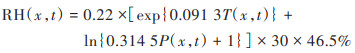
根据前人的研究[27~29], 笔者对黄土高原地区土壤异养呼吸的估算模型进行了对比, 最终采用Pei等[27]建立的经验公式, 该公式已被多个研究成功运用[30, 31]. 公式如下:
|
(2) |
式中, T和P分别为像元x在t月的平均温度(℃)和总降水量(mm).
将每年的月度RH数据相加得到年RH, 后用年NPP减去RH得到年NEP.
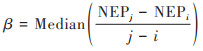
1.3.2 NEP变化趋势分析采用Theil-Sen中值趋势分析方法来探讨黄土高原NEP的变化趋势, 其计算公式如下:
|
(3) |
式中, β为NEP变化趋势;NEPi和NEPj分别表示第i年和第j年NEP的时间序列值(本研究中2 000 ≤ i < j ≤ 2 021). β > 0表示研究期内NEP变化呈增加趋势, β < 0表示研究期内NEP变化呈减少趋势.
采用Mann-Kendall方法对NEP变化趋势进行显著性检验. 对于标准值Z大于0, 则序列呈上升趋势;若小于0, 则序列呈下降趋势. 当Z的绝对值大于等于1.64、1.96和2.58时则说明该时间序列分别通过了置信水平90%、95%和99%的显著性检验.
1.3.3 皮尔逊相关分析利用相关性系数和显著性检验来揭示各驱动因子与NEP时空变化相关性的强弱.
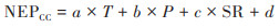
1.3.4 多元回归残差分析利用多元回归残差分析分离气候变化和人类活动对NEP变化的贡献. 通过建立年均气温、年降水量和年太阳总辐射与NEP的回归方程预测气候变化对NEP的影响(NEPCC);NEP观测值(NEPobs)与NEPCC之间的差值, 即NEPHA, 表示人类活动对NEP的影响.
|
(4) |

|
(5) |
式中, NEPCC和NEPobs分别表示基于回归模型的NEP预测值和NEP观测值;a、b、c和d为模型参数;T、P和SR分别为年均气温(℃)、年降水量(mm)和年太阳总辐射(MJ·m-2);NEPHA为残差.
利用一元线性回归法计算2000~2021年的NEPCC和NEPHA的变化趋势率, 分别表示在气候变化和人类活动影响下的NEP变化趋势. 趋势率为正表示气候变化或人类活动可促进NEP的增加;反之, 表示会导致NEP下降. 根据表 1对NEP变化的主要驱动因素进行区分, 计算气候变化和人类活动对NEP变化的贡献率.
|
|
表 1 NEP变化的驱动因素判定标准及贡献率计算方法1) Table 1 Criteria for determining the driving factors of NEP changes and calculation methods for contribution rate |


1.3.5 地理探测器模型
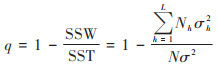
地理探测器是一种揭示空间异质性、基于4个模块量化驱动因素对响应变量影响[32]的空间统计方法. 本研究中主要使用因子探测和交互探测来分析黄土高原NEP空间差异的驱动机制. 因子探测主要是衡量驱动因素对响应变量空间变异的解释能力, 用q值来表示.
|
(6) |
式中, SSW和SST分别表示层内方差之和和全区总方差;h = 1, 2, 3, …, L为依赖或独立因素的分层;Nh和N分别为层h和全区的单元数;σh2和σ2分别为层h和全区NEP值的方差;0 ≤ q ≤ 1.
用交互探测来判断两个驱动因素的解释能力是增强、减弱或相互独立. 方法是对两个独立因素X1、X2的q值, 以及X1和X2交互探测的q值进行比较[32].
基于之前的研究[14, 33, 34], 并考虑到具体的数据可用性, 分别选取了气象因子(T、P、SR)、地形因子(ele、slope、aspect)和人为因子(HA)这7个潜在因子进行相关性和地理探测器分析. 其中地理探测器在要求离散自变量的前提下, 根据q统计值的最大值原则, 采用最优离散方法对连续自变量进行重新分类, 本研究基于R Studio软件中的“GD”包进行分类.
2 结果与分析 2.1 黄土高原NEP年际变化2000~2021年黄土高原年均NEP值(以C计, 下同)2001年最低为7.42 g·(m2·a)-1, 2018年最高为171.81 g·(m2·a)-1, 平均值为104.62 g·(m2·a)-1[图 2(a)];整体呈显著增长趋势(P < 0.05), 年均增长率为6.10 g·(m2·a)-1;22年间, 黄土高原碳源面积(NEP < 0)占比呈波动下降趋势, 其中2001年占比最大. 而随着NEP的增加, 2021年碳汇区域(NEP > 0)的面积百分比达到77%, 与2000年相比增加了27%[图 2(b)].

|
图 2 2000~2021年黄土高原NEP及碳源/汇年际变化 Fig. 2 Interannual changes in NEP and carbon source and sink in the Loess Plateau from 2000 to 2021 |
6个生态分区的年均NEP均呈显著增长趋势, 但增长速度不同(图 3). A2副区NEP年均值和年变化率均居首位, 分别为186.84 g·(m2·a)-1和9.04 g·(m2·a)-1, C区NEP年均值和年变化率均最小, 分别为-30.41 g·(m2·a)-1和2.74 g·(m2·a)-1. 就NEP年均值而言, B区和C区均小于黄土高原整个区域的平均水平;而除A1副区和C区外, 其余各生态分区变化率均大于黄土高原的变化率. 各生态分区最大值主要集中在2018年和2019年, 最小值除A1副区外均在2001年. 其中, 2018年A2副区NEP值最大为288.18 g·(m2·a)-1, 2001年C区NEP值最小为-80.09 g·(m2·a)-1. 整体来看除C区为弱碳源, 其余各分区均为显著的碳汇.

|
折线表示不同生态分区年均NEP变化值;虚线表示不同生态分区年均NEP线性拟合趋势 图 3 2000~2021年不同生态分区年均NEP年际变化趋势 Fig. 3 Interannual variation trend of average annual NEP in different ecological subregions from 2000 to 2021 |
黄土高原NEP整体呈现东南高西北低的空间分布格局(图 4). NEP < 0的面积占总面积的26.56%, 主要分布在C区大部分地区, A区北部和B区西北部也有分布;NEP > 0的面积占73.44%, 其中NEP高值区[ > 300 g·(m2·a)-1]占7.45%, 主要分布在A2副区西南部以及A1副区南部边缘地区.

|
图 4 2000~2021年黄土高原及其生态分区平均NEP空间分布 Fig. 4 Spatial distribution of annual mean NEP in the Loess Plateau and its ecological subregions from 2000 to 2021 |
NEP空间变化格局与其空间分布格局相似, 呈现由东南向西北递减的趋势[图 5(a)]. 2000~2021年, 黄土高原固碳能力以增长为主, 面积占比达98.55%, 显著(P < 0.05)或极显著(P < 0.01)增加的面积占全区域的89.41%, 其中, NEP的微增幅[2.5~5 g·(m2·a)-1]、中增幅[ 5~10 g·(m2·a)-1]和高增幅[ > 10 g·(m2·a)-1]面积占比分别为22.67%、47.28%和13.12%, 高增幅主要分布在A2副区中南部以及B2副区的西南部(如陕西延安、宝鸡, 甘肃庆阳和平凉等地). 负增长区域面积仅占1.45%, 零星分布在C区, D区以及A1副区等部分地区(图 5).

|
图 5 2000~2021年黄土高原NEP变化趋势和显著性水平空间分布与面积占比 Fig. 5 Spatial distribution and area proportion of NEP change trend and significance test in Loess Plateau from 2000 to 2021 |
黄土高原全区及各生态分区NEP的年际变化与HA均呈极显著正相关(P < 0.01), 相关系数均在0.80以上;除A2副区和D区外, 全区及其余生态分区的NEP与年降水量的年际变化相关性均达到了显著(P < 0.05)或者极显著水平(P < 0.01);全区及各生态分区NEP的年际变化与年均气温和年太阳总辐射相关性均未达到显著水平(P > 0.05)(图 6). 残差分析表明, 气候因素和人类活动对NEP年际变化的贡献率分别为37.33%和62.67%, 表明人类活动是引起NEP年际变化的主导因子(图 7). 黄土高原约19.37%的区域受气候因素的主导(贡献率 > 50%), 主要分布在C区北部、A1副区北部以及D区东北部[图 7(a)]. 人类活动对NEP变化的贡献率在79.81%的区域占主导, 其中贡献率大于75%的地区占区域面积的1/4, 集中分布在研究区中部和南部[图 7(b)]. 在6个分区中, 人类活动对NEP增长贡献率最高, 贡献率均在50%以上, 而气候因子贡献率在20% ~ 45%之间. 其中人类活动对A2副区贡献率最大(76.35%), 对C区贡献率最小(53.88%), 相应C区气候因素引起NEP增长的贡献率最大(46.12%), A2副区最小(23.65%).

|
*表示显著相关(P < 0.05);**表示极显著相关(P < 0.01) 图 6 黄土高原及各生态分区NEP的年际变化与环境因子年际变化的相关系数 Fig. 6 Correlation coefficients between the interannual variation in NEP and the interannual variation in environmental factors in the Loess Plateau and its ecological subregions |

|
图 7 气候变化和人类活动对黄土高原及各生态分区NEP增加的贡献率 Fig. 7 Contribution rates of climate change and human activities to the increase in NEP in the Loess Plateau and its ecological subregions |
因子的独立效应方面, 相关分析和因子探测均表明P(r = 0.72, q = 0.54)和SR(r = -0.56, q = 0.37)是影响黄土高原NEP空间格局的主要驱动因子(图 8), 其中SR和T与NEP呈负相关, 而HA和aspect对NEP的解释力相对较弱. 各生态分区的主要影响因子不同, A区、B1副区、B2副区、C区、D区分别是P、T、P和SR、SR、ele(图 8). 整体来看, 气象因素是黄土高原及各分区NEP空间变化的主要影响因素, 地形和人类活动的解释力相对较弱.

|
*表示显著相关(P < 0.05);**表示极显著相关(P < 0.01) 图 8 黄土高原NEP的空间分布与驱动因子的相关系数和因子探测q值 Fig. 8 Correlation coefficient and factor detection q value between NEP spatial distribution and driving factors in the Loess Plateau |
为了量化两因子的交互作用, 进一步做了交互探测分析, 表 2中列出了影响黄土高原全区和各生态分区NEP空间变化的主要影响因素(P、T、SR、ele)之间及其与其他影响因子(HA、slope、aspect)交互作用的q值. 结果表明, 成对因子的q值大于单个因子的q值或它们的总和, 说明两因子交互作用后对NEP空间变化的解释力更强. 黄土高原P ∩ T和P ∩ ele交互作用的q值最高, 均为0.72. A1副区、B1副区和D区P ∩ T的交互解释力最强, q值分别为0.77、0.86和0.56, A2副区SR ∩ T交互解释力最强, q值为0.89, B2副区P ∩ ele解释力最强, q值为0.82, 而C区T ∩ HA交互作用q值最高, 为0.60(表 2).
|
|
表 2 黄土高原及其生态分区交互探测结果 Table 2 Results of interactive detection of Loess Plateau and its ecological subregions |
3 讨论 3.1 时间尺度NEP变化分析
以往研究表明, 自1999年开始实施退耕还林/草工程以来, 黄土高原地区植被覆盖度明显提高[35~37]. 刘国彬等[35]报道了黄土高原2017年的林草覆盖率比1999年提高了33.6%, 水土保持林草及封禁治理面积达到24万km2以上;王逸男等[36]报道了2000年至2020年黄土高原植被覆盖度由0.39增加到0.61, 且2017年后提升速度加快. 国家政策和相关生态恢复措施等人为因素是引起黄土高原植被覆盖度增加的主要原因, 2000~2020年人类活动对黄土高原植被覆盖度变化的贡献率为65.22%, 气候变化为34.78%[37]. 植被恢复、退耕还林/草和森林经营等措施能够通过植物光合作用将大气中的CO2固定在植物和土壤中, 从而提升了黄土高原生态系统的固碳能力[38]. 张佑铭等[39]报道了1990~2015年黄土高原植被的NPP与植被固碳总体呈增加趋势, 年均NPP增速为2.74 g·(m2·a)-1;杨丹等[19]发现2000~2015年黄土高原植被NPP的平均增速为3.62 g·(m2·a)-1. 本研究结果表明, 2000~2021年黄土高原全区年均NEP呈显著增长趋势(P < 0.05), 增长速率为6.10 g·(m2·a)-1, 人类活动是引起黄土高原NEP年际变化的主要因素, 贡献率为62.67%, 这与Feng等[14]的研究结果一致.
6个生态分区NEP均呈增长趋势, 但增长速率有所差异. A区整体表现为显著的碳汇区, 碳汇增速也较快, 这与该区高植被覆盖率有关[40];而A2副区NEP增长速率最快, 这是因为A2副区温度、降水等自然条件优越[16], 且是固沟保塬、退耕还草的主要区域[14], 加之坡耕地整治和小流域综合治理等一系列生态修复工程的实施, 土壤侵蚀明显减弱, 植被以及区域生态环境得到了极大改善[41]. B区碳汇量相对较低, 这可能是由于早期该区过度放牧等不合理的土地利用, 使生态环境遭到严重破坏, 但在退耕还林/草等生态工程的支持下, 碳储量共计增加5.27×10⁴ t, 还林还草的碳汇贡献率超过50%, NEP增长速率加快, 植被覆盖度明显提高, 取得了显著的经济和生态效益[42]. C区是黄土高原主要的弱碳源区域, 气候干旱、降水稀少, 不合理的水资源利用导致地表植被减少, 植被的光合能力下降, 植被生产力受到限制. 该地区相较于其他分区, 更容易受到气候变化的干扰, 整体碳汇增长率较低[40], 且该区受人类活动影响较大, 长期的过牧滥牧造成严重的草原退化和沙化, 通过轮牧、禁牧和休牧等措施的实施[43], 以及生态工程的建设, 使得该地生态治理目标基本实现[44]. D区气候条件优越, 林地广布, 植被覆盖率高[16], 属于显著的碳汇区. 该区也是重要的农业区, 且聚集了西安、郑州和太原等大型城市, 区域经济活动频繁, 受人类活动影响强度较大, 近年来实施的山水林田湖草沙保护和修复工程, 增强了生态系统的固碳能力, 使得NEP年际变化率较高[45].
3.2 空间尺度NEP变化分析空间尺度上, 相关分析和因子探测结果均表明, 年降水量和年太阳总辐射是影响黄土高原NEP空间分异的主要驱动因子, 与之前大多数学者的研究结果相一致[30, 33]. 黄土高原年降水量均呈东南高西北低的空间格局[46], 与NEP空间分布高度一致. 水分是NEP变化的主要限制因子, 降水的增加促进浅根植物的发育, 进而促进NEP的增加[47];而黄土高原太阳辐射空间上自东南向西北递增, 与NEP空间分布相反. 热量的提高加大了区域的水分蒸散, 使土壤水分降低、植物受到干旱胁迫, 光合能力下降, 生态系统生产力受到制约, 进而抑制了植被的碳吸收和干物质积累[48]. 交互探测的结果也证明了这一点, 黄土高原全区及6个生态分区P ∩ SR的q值均大于单个因子的q值或大于两个因子q值的和(表 2), 表明年降水量和年太阳总辐射共同作用时会增加对NEP的解释能力. 此外, B区和D区与人类活动呈负相关关系, 这可能是该区域人口集聚效应强, 城乡建设用地急剧增长占用了大量的耕地, 土地利用格局发生变化, 且煤炭开采等人类干扰对NEP的增长产生了负面效应[49]. 除B2副区和C区外, 黄土高原全区和其他分区的P ∩ T或SR ∩ T的q统计值最高, 表明气候因素是引起黄土高原NEP空间变化的主要原因.
4 结论(1)2000~2021年黄土高原全区及各分区年均NEP均呈显著增长趋势, 年均增长率为2.74~9.04 g·(m2·a)-1, A2副区最大, C区最小. 2021年77%的区域为碳汇, 与2000年相比碳汇面积增加了27%, 除C区为弱碳源外, 其余各分区均为显著的碳汇.
(2)黄土高原年均NEP呈现东南高西北低的空间分布格局. 2000~2021年, 98.55%的区域固碳能力增长, A2副区中南部以及B2副区西南部增幅较大.
(3)人类活动是影响黄土高原NEP时间变化的主要因素, 对NEP年际变化的贡献率为62.67%, 气候变化的贡献率为37.33%;气候因素是影响黄土高原NEP空间变化的主要驱动因子.
| [1] | Princiotta F. Global climate change and the mitigation challenge[J]. Journal of the Air & Waste Management Association, 2009, 59(10): 1194-1211. |
| [2] | Friedlingstein P, O'Sullivan M, Jones M W, et al. Global carbon budget 2020[J]. Earth System Science Data, 2020, 12(4): 3269-3340. DOI:10.5194/essd-12-3269-2020 |
| [3] | Erb K H, Kastner T, Plutzar C, et al. Unexpectedly large impact of forest management and grazing on global vegetation biomass[J]. Nature, 2018, 553(7686): 73-76. DOI:10.1038/nature25138 |
| [4] | Piao S L, He Y, Wang X H, et al. Estimation of China's terrestrial ecosystem carbon sink: methods, progress and prospects[J]. Science China Earth Sciences, 2022, 65(4): 641-651. DOI:10.1007/s11430-021-9892-6 |
| [5] |
赵宁, 周蕾, 庄杰, 等. 中国陆地生态系统碳源/汇整合分析[J]. 生态学报, 2021, 41(19): 7648-7658. Zhao N, Zhou L, Zhuang J, et al. Integration analysis of the carbon sources and sinks in terrestrial ecosystems, China[J]. Acta Ecologica Sinica, 2021, 41(19): 7648-7658. |
| [6] |
徐勇, 黄雯婷, 郭振东, 等. 2000-2020年我国西南地区植被NEP时空变化及其驱动因素的相对贡献[J]. 环境科学研究, 2023, 36(3): 557-570. Xu Y, Huang W T, Guo Z D, et al. Spatio-temporal variation of vegetation net ecosystem productivity and relative contribution of driving forces in southwest China from 2000 to 2020[J]. Research of Environmental Sciences, 2023, 36(3): 557-570. |
| [7] |
刘凤, 曾永年. 2000-2015年青海高原植被碳源/汇时空格局及变化[J]. 生态学报, 2021, 41(14): 5792-5803. Liu F, Zeng Y N. Analysis of the spatio-temporal variation of vegetation carbon source/sink in Qinghai Plateau from 2000-2015[J]. Acta Ecologica Sinica, 2021, 41(14): 5792-5803. |
| [8] |
刘应帅, 余瑞, 郑彬彬, 等. 海南岛森林植被NEP季节性时空变化规律及气候驱动因素分析[J]. 热带生物学报, 2022, 13(2): 166-176. Liu Y S, Yu R, Zheng B B, et al. Analysis of seasonal spatial and temporal variation patterns of forest vegetation NEP and climate drivers in Hainan Island[J]. Journal of Tropical Biology, 2022, 13(2): 166-176. |
| [9] | Wei D, Qi Y H, Ma Y M, et al. Plant uptake of CO2 outpaces losses from permafrost and plant respiration on the Tibetan Plateau[J]. Proceedings of the National Academy of Sciences of the United States of America, 2021, 118(33). DOI:10.1073/pnas.2015283118 |
| [10] | Zhang J J, Hao X M, Hao H C, et al. Climate change decreased net ecosystem productivity in the arid region of central Asia[J]. Remote Sensing, 2021, 13(21). DOI:10.3390/rs13214449 |
| [11] | Keenan T F, Prentice I C, Canadell J G, et al. Recent pause in the growth rate of atmospheric CO2 due to enhanced terrestrial carbon uptake[J]. Nature Communications, 2016, 7. DOI:10.1038/ncomms13428 |
| [12] | Piao S L, Fang J Y, Ciais P, et al. The carbon balance of terrestrial ecosystems in China[J]. Nature, 2009, 458(7241): 1009-1013. DOI:10.1038/nature07944 |
| [13] | Lu F, Hu H F, Sun W J, et al. Effects of national ecological restoration projects on carbon sequestration in China from 2001 to 2010[J]. Proceedings of the National Academy of Sciences of the United States of America, 2018, 115(16): 4039-4044. |
| [14] | Feng X M, Fu B J, Lu N, et al. How ecological restoration alters ecosystem services: an analysis of carbon sequestration in China's Loess Plateau[J]. Scientific Reports, 2013, 3. DOI:10.1038/srep02846 |
| [15] |
张祯祺, 蔡惠文, 张平平, 等. 基于GEE遥感云平台的三江源植被碳源/汇时空变化研究[J]. 自然资源遥感, 2023, 35(1): 231-242. Zhang Z Q, Cai H W, Zhang P P, et al. A GEE-based study on the temporal and spatial variations in the carbon source/sink function of vegetation in the Three-River Headwaters region[J]. Remote Sensing for Natural Resources, 2023, 35(1): 231-242. |
| [16] |
杨艳芬, 王兵, 王国梁, 等. 黄土高原生态分区及概况[J]. 生态学报, 2019, 39(20): 7389-7397. Yang Y F, Wang B, Wang G L, et al. Ecological regionalization and overview of the Loess Plateau[J]. Acta Ecologica Sinica, 2019, 39(20): 7389-7397. |
| [17] | Xiao J F. Satellite evidence for significant biophysical consequences of the "Grain for Green" Program on the Loess Plateau in China[J]. Journal of Geophysical Research: Biogeosciences, 2014, 119(12): 2261-2275. DOI:10.1002/2014JG002820 |
| [18] |
师贺雄. 长江、黄河中上游地区退耕还林工程生态效益特征及价值化研究[D]. 北京: 中国林业科学研究院, 2016. Shi H X. Study on ecological effect characteristics and valuing physical account from Grain for Green Project in regions containing the upper and middle reaches of China's Yangtze and Yellow River[D]. Beijing: Chinese Academy of Forestry, 2016. |
| [19] |
杨丹, 王晓峰. 黄土高原气候和人类活动对植被NPP变化的影响[J]. 干旱区研究, 2022, 39(2): 584-593. Yang D, Wang X F. Contribution of climatic change and human activities to changes in net primary productivity in the Loess Plateau[J]. Arid Zone Research, 2022, 39(2): 584-593. |
| [20] |
刘欢欢, 陈印, 刘悦, 等. 基于随机森林模型的黄土高原草地净初级生产力时空格局及未来演变趋势模拟[J]. 干旱区研究, 2023, 40(1): 123-131. Liu H H, Chen Y, Liu Y, et al. Simulation of spatial pattern and future trends of grassland net primary productivity in the Loess Plateau based on random forest model[J]. Arid Zone Research, 2023, 40(1): 123-131. |
| [21] |
李妙宇, 上官周平, 邓蕾. 黄土高原地区生态系统碳储量空间分布及其影响因素[J]. 生态学报, 2021, 41(17): 6786-6799. Li M Y, Shangguan Z P, Deng L. Spatial distribution of carbon storages in the terrestrial ecosystems and its influencing factors on the Loess Plateau[J]. Acta Ecologica Sinica, 2021, 41(17): 6786-6799. |
| [22] |
王一贺, 赵允格, 李林, 等. 黄土高原不同降雨量带退耕地植被-生物结皮的分布格局[J]. 生态学报, 2016, 36(2): 377-386. Wang Y H, Zhao Y G, Li L, et al. Distribution patterns and spatial variability of vegetation and biocrusts in revegetated lands in different rainfall zones of the Loess Plateau region, China[J]. Acta Ecologica Sinica, 2016, 36(2): 377-386. |
| [23] | 韩红珠. 黄土高原植被物候和净初级生产力(NPP)的关系及其对气候变化的响应[D]. 西安: 陕西师范大学, 2020. |
| [24] | Peng S Z, Ding Y X, Liu W Z, et al. 1 km monthly temperature and precipitation dataset for China from 1901 to 2017[J]. Earth System Science Data, 2019, 11(4): 1931-1946. DOI:10.5194/essd-11-1931-2019 |
| [25] |
朱玉果, 杜灵通, 谢应忠, 等. 不同气象插值方法精度评估及对草地NPP估算的影响[J]. 水土保持研究, 2018, 25(6): 160-167. Zhu Y G, Du L T, Xie Y Z, et al. Evaluation on accuracy of three meteorological interpolation methods and their impacts on grassland NPP estimation[J]. Research of Soil and Water Conservation, 2018, 25(6): 160-167. |
| [26] | Mu H W, Li X C, Wen Y N, et al. A global record of annual terrestrial human footprint dataset from 2000 to 2018[J]. Scientific Data, 2022, 9(1). DOI:10.1038/s41597-022-01284-8 |
| [27] | Pei Z Y, Ouyang H, Zhou C P, et al. Carbon balance in an alpine steppe in the Qinghai-Tibet Plateau[J]. Journal of Integrative Plant Biology, 2009, 51(5): 521-526. DOI:10.1111/j.1744-7909.2009.00813.x |
| [28] |
张梅, 黄贤金, 揣小伟, 等. 中国净生态系统生产力空间分布及变化趋势研究[J]. 地理与地理信息科学, 2020, 36(2): 69-74. Zhang M, Huang X J, Chuai X W, et al. Spatial distribution and changing trends of net ecosystem productivity in China[J]. Geography and Geo-Information Science, 2020, 36(2): 69-74. DOI:10.3969/j.issn.1672-0504.2020.02.011 |
| [29] |
谢薇, 陈书涛, 胡正华. 中国陆地生态系统土壤异养呼吸变异的影响因素[J]. 环境科学, 2014, 35(1): 334-340. Xie W, Chen S T, Hu Z H. Factors influencing the variability in soil heterotrophic respiration from terrestrial ecosystem in China[J]. Environmental Science, 2014, 35(1): 334-340. |
| [30] |
王菲, 曹永强, 周姝含, 等. 黄河流域生态功能区植被碳汇估算及其气候影响要素[J]. 生态学报, 2023, 43(6): 2501-2514. Wang F, Cao Y Q, Zhou S H, et al. Estimation of vegetation carbon sink in the Yellow River Basin ecological function area and analysis of its main meteorological elements[J]. Acta Ecologica Sinica, 2023, 43(6): 2501-2514. |
| [31] |
冶晓娟, 王永辉, 潘红忠, 等. 青海省植被NEP时空变化及驱动因素分析[J]. 干旱区研究, 2022, 39(5): 1673-1683. Ye X J, Wang Y H, Pan H Z, et al. Spatial-temporal variation and driving factors of vegetation net ecosystem productivity in Qinghai Province[J]. Arid Zone Research, 2022, 39(5): 1673-1683. |
| [32] | Wang J F, Zhang T L, Fu B J. A measure of spatial stratified heterogeneity[J]. Ecological Indicators, 2016, 67: 250-256. DOI:10.1016/j.ecolind.2016.02.052 |
| [33] |
韩玉, 丁素婷, 杨太保. 山西南部中条山生态系统碳储量时空分布及驱动因素[J]. 中国环境科学, 2023, 43(3): 1298-1306. Han Y, Ding S T, Yang T B. Spatial and temporal distribution and driving factors of carbon storage in Zhongtiao Mountain ecosystem in southern Shanxi Province[J]. China Environmental Science, 2023, 43(3): 1298-1306. DOI:10.3969/j.issn.1000-6923.2023.03.031 |
| [34] |
杨艳, 周德成, 宫兆宁, 等. 基于植被生产力的黄土高原地区生态脆弱性及其控制因子分析[J]. 生态环境学报, 2022, 31(10): 1951-1958. Yang Y, Zhou D C, Gong Z N, et al. Ecological vulnerability and its drivers of the Loess Plateau based on vegetation productivity[J]. Ecology and Environmental Sciences, 2022, 31(10): 1951-1958. |
| [35] |
刘国彬, 上官周平, 姚文艺, 等. 黄土高原生态工程的生态成效[J]. 中国科学院院刊, 2017, 32(1): 11-19. Liu G B, Shangguan Z P, Yao W Y, et al. Ecological effects of soil conservation in Loess Plateau[J]. Bulletin of Chinese Academy of Sciences, 2017, 32(1): 11-19. |
| [36] |
王逸男, 孔祥兵, 赵春敬, 等. 2000-2020年黄土高原植被覆盖度时空格局变化分析[J]. 水土保持学报, 2022, 36(3): 130-137. Wang Y N, Kong X B, Zhao C J, et al. Change of vegetation coverage in the Loess Plateau from 2000 to 2020 and its spatiotemporal pattern analysis[J]. Journal of Soil and Water Conservation, 2022, 36(3): 130-137. |
| [37] | Fan X Y, Gao P, Tian B Q, et al. Spatio-temporal patterns of NDVI and its influencing factors based on the ESTARFM in the Loess Plateau of China[J]. Remote Sensing, 2023, 15(10). DOI:10.3390/rs15102553 |
| [38] |
杨阳, 张萍萍, 吴凡, 等. 黄土高原植被建设及其对碳中和的意义与对策[J]. 生态学报, 2023, 43(21): 9071-9081. Yang Y, Zhang P P, Wu F, et al. The significance and countermeasures of vegetation construction on the Loess Plateau to carbon neutrality[J]. Acta Ecologica Sinica, 2023, 43(21): 9071-9081. |
| [39] |
张佑铭, 郎梦凡, 刘梦云, 等. 土地利用转变与海拔高度协同作用黄土高原植被固碳变化特征[J]. 生态学报, 2022, 42(10): 3897-3908. Zhang Y M, Lang M F, Liu M Y, et al. Vegetation carbon sequestration in the Loess Plateau under the synergistic effects of land cover change and elevations[J]. Acta Ecologica Sinica, 2022, 42(10): 3897-3908. |
| [40] |
何亮. 黄土高原植被覆盖变化特征及驱动力分析[D]. 呼和浩特: 内蒙古农业大学, 2021. He L. Analysis on the variation characteristics and driving forces of vegeation cover in the Loess Plateau[D]. Hohhot: Inner Mongolia Agricultural University, 2021. |
| [41] |
沙小燕, 李魁, 王文龙, 等. 黄土高塬沟壑区草地沟头立壁土壤抗冲性特征[J]. 应用生态学报, 2022, 33(1): 133-140. Sha X Y, Li K, Wang W L, et al. Characteristics of soil anti-scouribility in gully head wall of grass-covering on the gullied Loess Plateau, Northwest China[J]. Chinese Journal of Applied Ecology, 2022, 33(1): 133-140. |
| [42] |
姚楠, 刘广全, 姚顺波, 等. 基于InVEST模型的黄土丘陵沟壑区退耕还林还草工程对生态系统碳储量的影响评估[J]. 水土保持通报, 2022, 42(5): 329-336. Yao N, Liu G Q, Yao S B, et al. Evaluating on effect of conversion from farmland to forest and grassland porject on ecosystem carbon storage in loess hilly-gully region based on InVEST model[J]. Bulletin of Soil and Water Conservation, 2022, 42(5): 329-336. |
| [43] |
姜亚东, 刘鑫, 郑颖, 等. 内蒙古草地资源退化现状及生态修复探索[J]. 草原与草业, 2023, 35(1): 57-61. Jiang Y D, Liu X, Zheng Y, et al. Degradation status of grassland resources and exploration of ecological restoration in Inner Mongolia[J]. Grassland and Prataculture, 2023, 35(1): 57-61. |
| [44] |
王岳, 刘学敏, 哈斯额尔敦. 荒漠化治理"经济-生态-社会"效益耦合协调度时空分异及其驱动因素——以毛乌素沙地为例[J]. 资源科学, 2022, 44(6): 1224-1237. Wang Y, Liu X M, Hasi E E D. Spatiotemporal differentiation and driving factors of coupling coordination degree of economic-ecological-social benefits from desertification control in the Mu Us Sandy Land[J]. Resources Science, 2022, 44(6): 1224-1237. |
| [45] |
庄少豪. 黄土高原生态系统服务功能对植被恢复的响应关系研究[D]. 西安: 西安理工大学, 2020. Zhuang S H. Study on the response relationship of ecosystem service funtion of Loess Plateau to vegetation restortion[D]. Xian: Xi'an University of Technology, 2020. |
| [46] |
王麒翔, 范晓辉, 王孟本. 近50年黄土高原地区降水时空变化特征[J]. 生态学报, 2011, 31(19): 5512-5523. Wang Q X, Fan X H, Wang M B. Precipitation trends during 1961—2010 in the Loess Plateau region of China[J]. Acta Ecologica Sinica, 2011, 31(19): 5512-5523. |
| [47] | Chen H, Zhu Q A, Peng C H, et al. The impacts of climate change and human activities on biogeochemical cycles on the Qinghai-Tibetan Plateau[J]. Global Change Biology, 2013, 19(10): 2940-2955. DOI:10.1111/gcb.12277 |
| [48] | Gottfried M, Pauli H, Futschik A, et al. Continent-wide response of mountain vegetation to climate change[J]. Nature Climate Change, 2012, 2(2): 111-115. DOI:10.1038/nclimate1329 |
| [49] |
张赫, 彭千芮, 王睿, 等. 中国县域碳汇时空格局及影响因素[J]. 生态学报, 2020, 40(24): 8988-8998. Zhang H, Peng Q R, Wang R, et al. Spatiotemporal patterns and factors influencing county carbon sinks in China[J]. Acta Ecologica Sinica, 2020, 40(24): 8988-8998. |